★
Camp · Swim & Beach · View
Big Arm Unit, Flathead Lake State Park
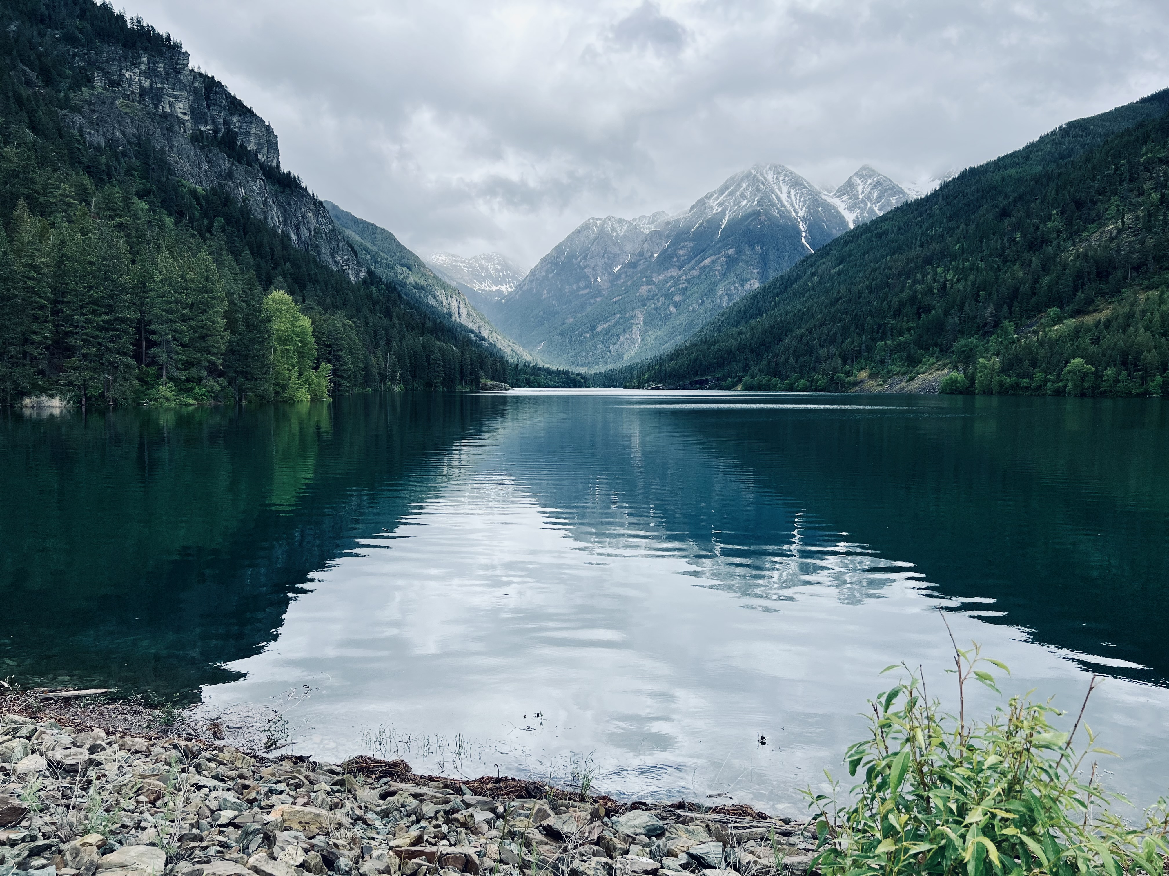
Cobble shoreline, summer camping, picnic areas, and the launch point for Wild Horse Island shuttles. The closest unit of Flathead Lake State Park to Polson.
Explore Mission Valley
The lakes, trails, refuges, and back roads of the Mission Valley.
Where the directory ends, this begins. Every entry is a public destination, every one links to the agency that manages it, and every one says so when conditions change faster than we can. Tribal lands, federal refuges, state parks, county roads. Check the agency before you drive.
The Mission Valley sits on a patchwork of public lands. Two national wildlife refuges. Four units of Flathead Lake State Park. The forty-some miles of east-shore Highway 35. The CSKT-administered Bison Range and the Mission Mountains tribal wilderness. Plus the city parks, the state-managed fishing access points, and the federal forest along the north and east edges of the valley.
Adventure is our guide to all of it. Public destinations that aren't businesses but are absolutely what visitors come here for. Every entry links to the authoritative source for current conditions, hours, and permits. We don't replace those sources. We index them and explain what we can.
A note on permits. Visiting most of the trails and waters inside CSKT-administered land requires a current tribal permit. We flag this on every relevant entry and link directly to where to buy. See the Permits & Licenses Guide for the full picture.
A note on draft entries. For places on CSKT-administered land, the practical details are verified, but the fuller story is held back until it can be written with CSKT contributors. Those entries carry a review banner.
Start here
The first 6 places we'd send a first-time visitor. Editorial picks, never paid placement.
Browse everything
The full set, grouped by what you can do there. Filter by area or activity.
Before you go
Which permit, where to buy, what to verify. CSKT, Montana state, federal.
The valley's outdoor headliners. Each is the kind of place that anchors a visit.
Camp · Swim & Beach · View
Cobble shoreline, summer camping, picnic areas, and the launch point for Wild Horse Island shuttles. The closest unit of Flathead Lake State Park to Polson.
Drive · Hike · View · Wildlife
Roughly 19,000 acres of native grassland and Douglas-fir forest in the Charlo area, home to a bison herd of 300+ animals. Operated by CSKT since 2022.
View
An open-air Buddhist sculpture garden outside Arlee. Free and open to the public year-round. Genuinely transporting under snow and in the long Mission Valley evenings.
Drive · View · Wildlife
Glacial pothole wetlands between Charlo and Ronan, on the Pacific Flyway. Sandhill cranes in spring, waterfowl most of the year, bald eagles in winter.
View · Wildlife
Smaller and quieter than Ninepipes. A pair of shallow lakes and bordering grassland just outside Pablo, on the Pacific Flyway.
Hike · View · Wildlife
The largest island on Flathead Lake. Bighorn sheep, wild horses, bald eagles, rough trails to a summit. Boat or shuttle access only.
Everything we list, grouped by what you can do there.
Camp · Swim & Beach · View
Cobble shoreline, summer camping, picnic areas, and the launch point for Wild Horse Island shuttles. The closest unit of Flathead Lake State Park to Polson.
Camp · Swim & Beach · View
A small lakeside campground on the east bay of Flathead Lake, six miles northeast of Polson.
Camp · Swim & Beach · View
A small east-shore state park with a sand-and-gravel beach, summer camping, and the cherry orchard backdrop. About 15 miles north of Polson on Highway 35.
Drive · Hike · View · Wildlife
Roughly 19,000 acres of native grassland and Douglas-fir forest in the Charlo area, home to a bison herd of 300+ animals. Operated by CSKT since 2022.
Drive · View
Highway 35 along Flathead Lake's east shore between Polson and Bigfork. Cherry orchards, lake-side state parks, the longer scenic route to or from Glacier.
Drive · Wildlife
The US 93 corridor through the Mission Valley runs one of the most extensive wildlife-crossing systems in North America.
Drive · View
A drive along the east-side roads at the foot of the Mission Mountains. The Missions look bigger up close than they do from US 93.
Drive · View · Wildlife
Glacial pothole wetlands between Charlo and Ronan, on the Pacific Flyway. Sandhill cranes in spring, waterfowl most of the year, bald eagles in winter.
Fish · Paddle
The Flathead River exits Flathead Lake at Polson and runs south toward the Clark Fork.
Fish · Hike · Paddle · View
A glacier-carved lake in the Mission Mountains east of Ronan, on CSKT land. Permit required.
Fish · Hike · Paddle · View
A lake in the Mission Mountains tribal wilderness east of St. Ignatius. CSKT-administered; tribal recreation permit required.
Hike · View
A trail east of St. Ignatius into the Mission Mountains tribal wilderness, leading to Mission Falls. On CSKT land; tribal recreation permit required for access.
Hike · View
The first wilderness in America an Indian nation set aside on its own land, protected by the Tribes' own ordinance since 1982.
Hike · View · Wildlife
The largest island on Flathead Lake. Bighorn sheep, wild horses, bald eagles, rough trails to a summit. Boat or shuttle access only.
View
An open-air Buddhist sculpture garden outside Arlee. Free and open to the public year-round. Genuinely transporting under snow and in the long Mission Valley evenings.
View · Wildlife
Smaller and quieter than Ninepipes. A pair of shallow lakes and bordering grassland just outside Pablo, on the Pacific Flyway.
View
A lakefront promenade near KwaTaqNuk in Polson. Sits in an area of CSKT cultural significance; framing held for CSKT review.
Long-form pieces that connect the dots between the places on this page.
Evergreen
The Mission Valley in winter is a different valley. Fewer cars on 93, lake views without the boat noise, snow on the Missions, the cold-stretched daylight of late northern winter.
Read the storyEvergreen
The Mission Valley doesn't have a celebrated dining scene. It has restaurants. Bakeries, bar grills, diner counters, a steakhouse, a few cafes you would drive an hour for if you knew.
Read the storyPractical
St. Ignatius is the kind of town that fits a day. Small enough to walk most of it, dense enough with mission-era history and mountain-front trails that twelve hours go somewhere.
Read the storyEvergreen
Highway 93 is the spine of the Mission Valley. Strung along it like beads on a wire, from Big Arm on the lake to Arlee at the south end.
Read the story